Organize and access geotagged photos, videos, and documents in one secure, searchable system.


Manage growing libraries of fieldwork photos, inspection records, and reports by location
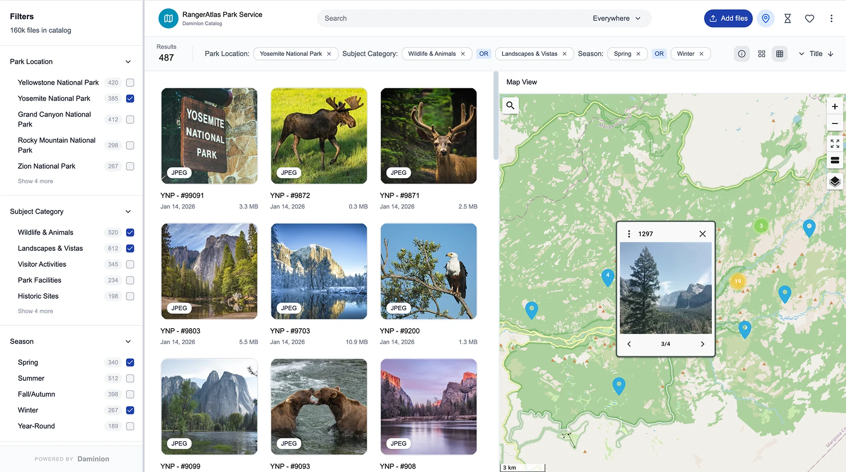
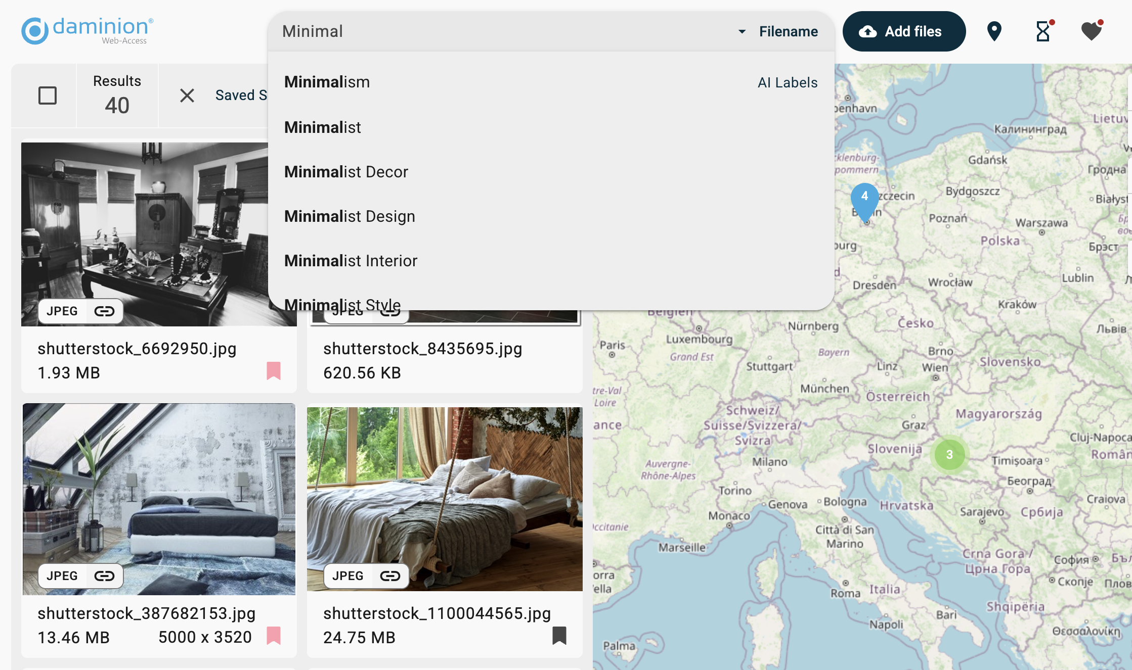
Daminion automatically preserves GPS metadata and displays your assets on a map.
Save hours of searching, improve reporting quality, and keep archives accessible for years.
Batch-Import and tag thousands of location-based files at once. Whether you’re managing inspection photos, conservation data, or field research, your assets are instantly linked to locations.
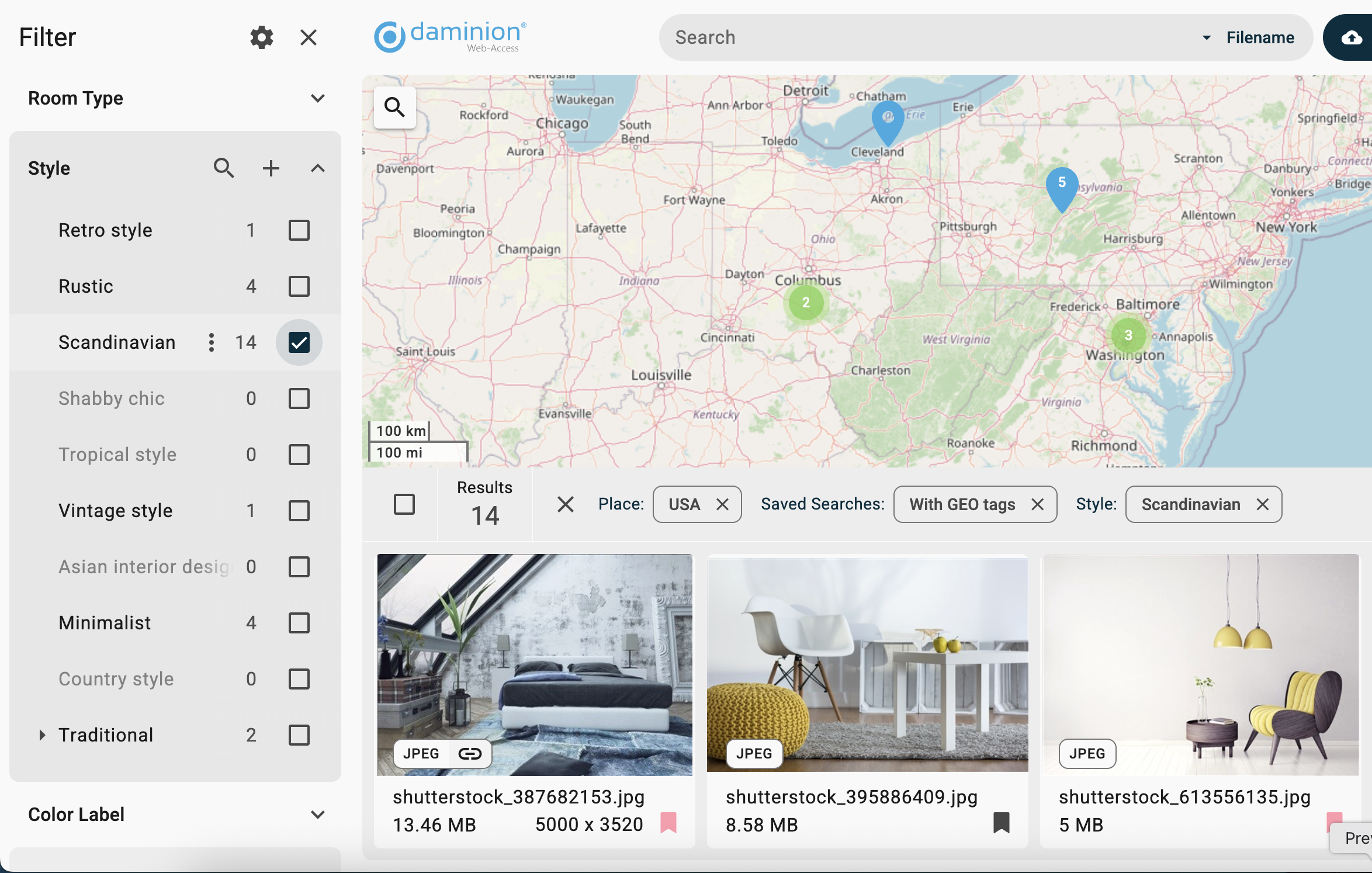
Struggling to remember where that field or inspection photo was taken? Daminion uses GPS coordinates to visualize all the tagged assets on an interactive map, so you can instantly trace geospatial assets by location.
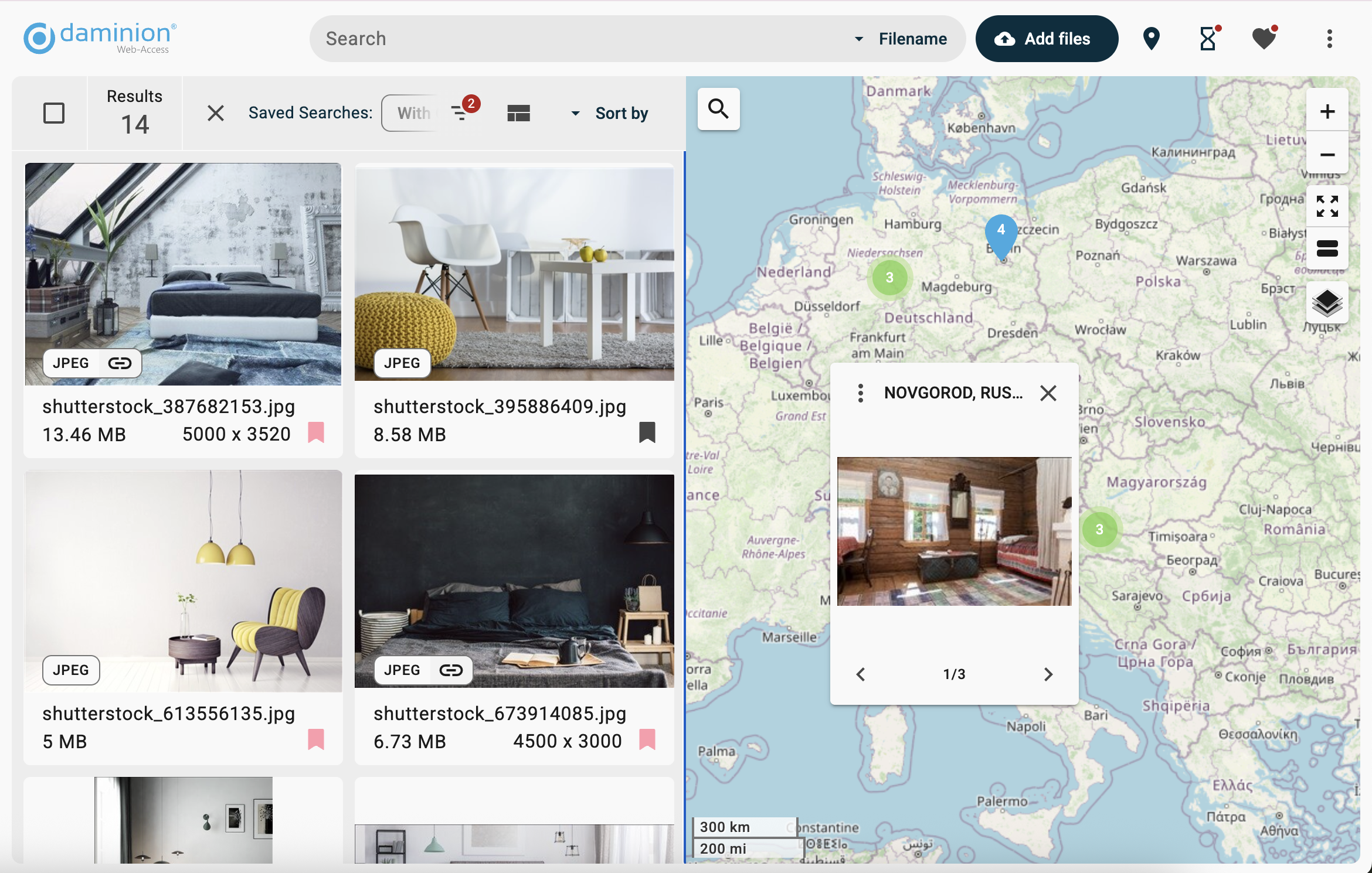
Combine spatial search with keywords, categories, and filters. Find assets by date, project, or subject — the way your team works best.
Keep control of your growing library with on-premises deployment:

Built for teams working with location-rich archives at scale
Keep geospatial archives on your own servers or NAS. Predictable storage costs, no cloud dependency.
Designed to handle hundreds of thousands of photos, fieldwork records, and inspection videos without slowdowns.
Relied on by government agencies, environmental organizations, and water management authorities to organize decades of geospatial data.
From water management to conservation, Daminion helps teams save time and improve reporting
Find out how Daminion supports your location-based data and archives
Yes. Daminion is optimized for large libraries and scales to millions of assets, including inspection photos, environmental imagery, and reports, without slowdowns.
Absolutely. Daminion imports all existing metadata — GPS coordinates, timestamps, and custom tags — so your archives remain accurate and compliant.
Yes. With on-prem deployment, storage costs are predictable and don’t grow with your archive size like cloud fees. Flexible licensing (annual or lifetime) ensures you stay within budget.
Granular role-based permissions let you control exactly who can view, edit, or share files. External sharing uses secure expiring links. On-prem deployment keeps all data inside your infrastructure.
Yes. Because Daminion runs on your servers or NAS, teams can access archives even with limited or no internet — ideal for fieldwork or remote areas.
Organizations share how Daminion helps them find the right assets by location, faster and with less stress
Our team is here to answer your questions, understand your challenges, and show you how Daminion can help.