
DAM With Geotagging Features: Top 3 Solutions in 2026

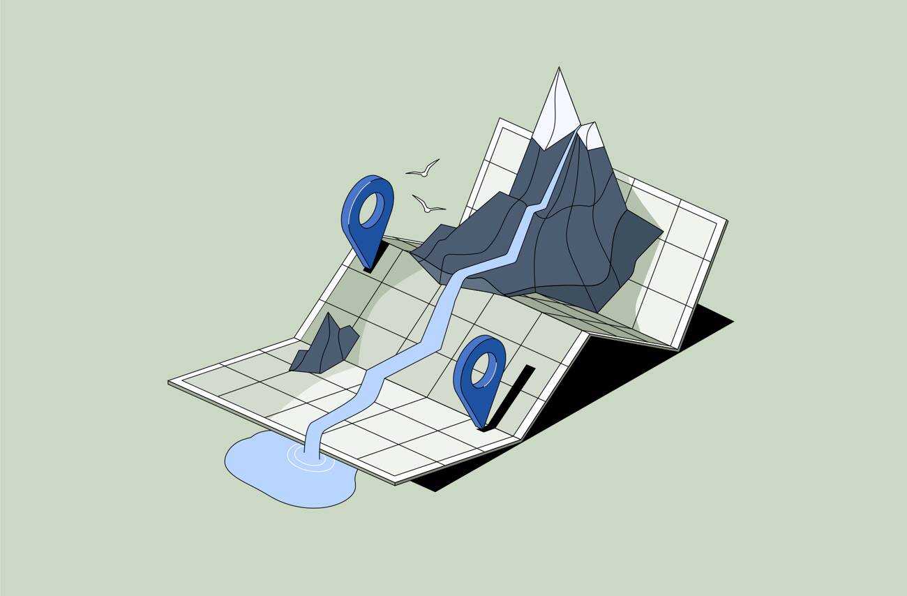
Imagine this: your team has been on the go, rushing back and forth between different locations, capturing numerous photos, videos, drone footage recordings, and more. Naturally, after weeks of work, all these assets end up scattered across devices and folders. So, an all too habitual grunting fills the office when you start to search for a file from a specific location. Where is that new photo of Park Street? Looks more like Woodland Avenue to me… Meanwhile, the clock is ticking, and the project deadline is looming.
Sounds familiar? Without a reliable tool, preparing such reports or other assignments with location-based assets can quickly become disorienting, derailing the entire workflow.
In this article, we’ll explore why a digital asset management (DAM) system with geotagging features is a real lifesaver in situations like these and how top solutions like Daminion help effectively organize your digital assets according to their geospatial data.
No more guessing about which location that was, no more last-minute reshooting, and no more stress — everything is neatly indexed and ready when you need it.

Discover How Daminion Can Work for You
What is DAM with GIS Integration?
Digital Asset Management software is a comprehensive tool that acts like a skillful cartographer for your digital library, meticulously mapping, sorting, and organizing your digital assets.
Coupled with GIS integration, such systems offer geospatial data tagging that acts like a compass, allowing your team to link assets to specific locations on the map so that no valuable files are lost in the digital wilderness.
Tip: If your team requires not just convenience and efficiency but also an extra layer of security for your confidential files, tools like Daminion offer an on-prem solution to keep your files local on your company’s servers, without them accidentally going global.
Why DAM with Geotagging is a Game Changer for Your Team
DAM successfully takes the pain out of dealing with geo-spatial data. Let’s look at how a good DAM system can transform your workflow.
1. Organize Smart With Geotagging
Among the key advantages of such solutions is that you can easily map your digital assets. With a robust DAM solution, it can be as effortless as dragging and dropping your files onto the map! The system will automatically save these coordinates to help you search for the files later on.
Why is it useful? If your team often finds themselves working on location-based projects, using GPS-referencing helps you quickly visualize and group them geographically, which:
- Improves file search and retrieval without any hour-long searches.
- Simplifies file organization to help you intuitively manage your ever-growing digital library.
- Prevents any double-work or reshooting to save you time and resources.
2. Simplify Collaboration and Reporting
Thanks to a GIS integration, DAM empowers your team to effortlessly create location-specific reports, presentations, or any other documentation.
How? As we now know, geotags label assets with specific geographic coordinates. This means that when you need to reference a specific district or project site, you can immediately locate and compile all related assets. This, in turn, allows you to
- Reduce errors in reporting by using the most relevant files tied to precise locations.
- Ensure greater comprehension with engaging visual content that provides a more accurate and credible overview of the project site or area.
3. Enhance Security With On-Prem Solution
If your team works with highly confidential and regulated information — from governmental institutions, infrastructure projects, and environmental monitoring — data security is one of your top priorities.
In such cases, on-premise DAM solutions with GIS integration may be particularly useful in maintaining control and confidentiality.
Since on-prem DAM is hosted directly on your company’s internal server rather than being stored on the cloud by third-party providers, you can rest assured that all the geotagged assets are safe and sound. Therefore, you benefit from:
- Compliance with tight regulations (FISMA, GDPR, etc.) by having full control over the data on your company’s servers.
- Customized security protocols with tailored access controls and role-based permissions to your location-based assets.
- Improved performance by storing your files locally, eliminating any dependency on internet speeds or cloud service outages. This can be particularly useful if your team works with large, high-resolution files like GIS maps, construction blueprints, etc.
💡 On-prem DAM solution offers so much more than boosted security and performance. Find out how your team can benefit from it in our latest article.
Selecting the Best DAM Software for Geospatial Data Management
What criteria should you use when you’re choosing GIS-enabled DAM software? Here are some pointers for you to give you a sense of direction:
1. Comprehensive Geotagging Features
This is, of course, one of the most important features. Having reliable DAM software with robust geotagging capabilities can save the day both for your team and clients.1. Geotagging Features
This is, of course, one of the most important features. Having reliable DAM software with robust geotagging capabilities can save the day both for your team and clients.
2. Support For Geospatial File Formats
The system you choose should support the important file formats used for geospatial data. Ideally, you should be able to preview the files directly from within the DAM software. These may include: GeoTIFF, raster images, vector images, etc.
3. Seamless Integration With GIS Software
No less useful, especially if your team works with industry-specific tools. Whichever DAM you choose, make sure it can seamlessly integrate with other GIS software, like:
- Waven
- ArcGIS
- ArcMap
- AutoCAD
4. Strong Data Security and Compliance Features
If you need to deal with sensitive data on a regular basis, the software should:
- Allow you to set highly granular, specific permissions. You should be able to customize access controls to meet your own specific needs.
- Encrypt your data to protect against hacking.
- Make it easy to comply with data privacy laws.
5. Flexible Deployment and Pricing
Especially if you’re a small or medium-sized team, you have to put up with tight budgets. So you need to compare options in this area.
- Pricing shouldn’t be "one size fits all". You should be able to choose an option that suits the size of your team and your library and offers the features you need. Some DAM vendors, including Daminion, offer special packages for non-profit organizations.
- Deployment can be in the cloud, on-premise, or hybrid. On-premise options generally provide more robust security and allow you to expand your library without additional storage costs.
Top 3 GIS-Enhanced DAM Software to Look Out For in 2026
Let’s look at some of the GIS-enabled DAM systems currently in the marketplace.
1. Daminion: Comprehensive Solution with Geospatial Power
Daminion is a robust, versatile digital asset management platform that simplifies managing location-based assets for small and medium organizations. Thanks to robust geotagging features and map visualization, you can quickly put your files on the map for easy file search and library organization.
Pros:
- Offers geotagging and map-based visualization to sort out files based on specific locations. Additionally, Daminion offers AI autotagging and custom tags for more precise file categorization and search later on.
- Supports over 100 different file types, including widely-used geospatial formats like GeoTIFF and JPEG with EXIF data, with direct previews for most files.
- Integrates seamlessly with popular GIS software. You can connect photos to spatial tools and link assets to maps.
- Provides customizable and highly granular access controls, role-based permissions, and file version controls to ensure secure file sharing and compliance with regulations.
- Offers a flexible deployment, including on-premise, cloud, and hybrid. The on-prem option allows for enhanced security and performance, keeping your assets safe on your local servers.
Cons:
- Although being a comprehensive solution, Daminion doesn’t have the advanced features of a dedicated GIS system found in dedicated GIS software. But it integrates well with other tools to provide more functionality.
2. AssetBank
AssetBank is a reliable DAM system with flexible tagging, filtering, and search options. It has an optional GIS module that allows map-based search and filtering facilities.
Pros:
- Supports a wide range of metadata, including GPS locations;.
- Good collaboration and version control facilities.
- Privacy and security facilities are customizable and comprehensive.
- Offers cloud, on-premise, and hybrid deployment options.
Cons:
- AssetBank doesn’t directly support all the file formats that may be used to store geospatial data.
- The integration support for GIS-related systems is limited.
3. Extensis Portfolio
Extensis Portfolio is a tried-and-trusted DAM solution, which, since it incorporated LizardTech’s geospatial facilities, integrates well into GIS-enabled workflows.
Pros:
- Able to compress large files for faster processing.
- Supports most standard file formats.
- Integrates with specialized GIS tools.
Cons:
- The cost is relatively high for organizations working on a tight budget.
- Only supports cloud-based deployment, which can add to the cost and processing time when dealing with large libraries.
Comparison of Top DAM Software for Location-Based Assets
Let’s compare these three software packages side by side in terms of the selection criteria listed earlier in the article.
Each of these three solutions solves many of the problems faced by teams dealing with large location assets that must be kept well-organized.
Daminion, however, tops the list due to its extensive support for various asset organization options (geotagging, mapping, custom tagging, etc.), extensive file format support, compatibility with popular GIS tools, reasonable cost and flexible deployment options.
Case Studies: Real-World Success with Daminion
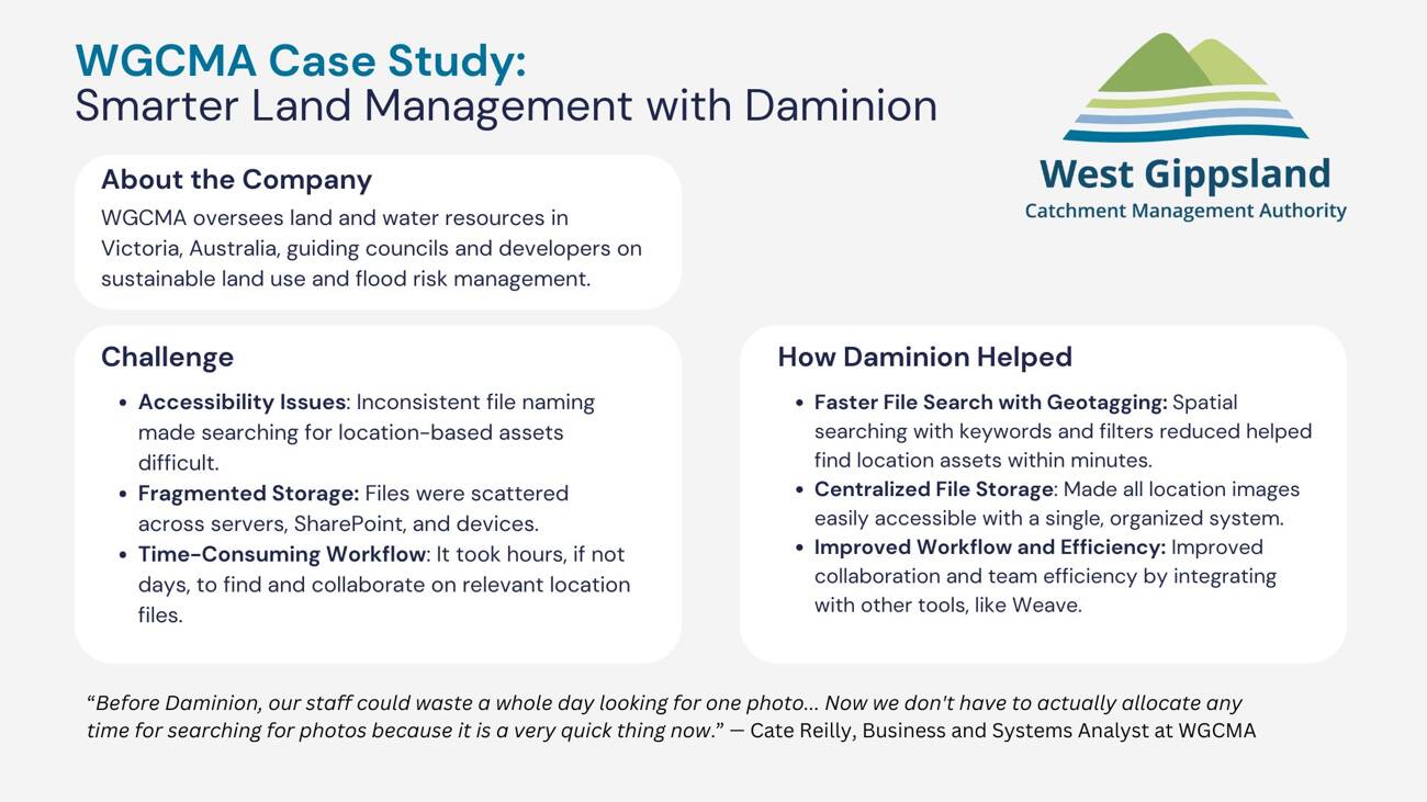
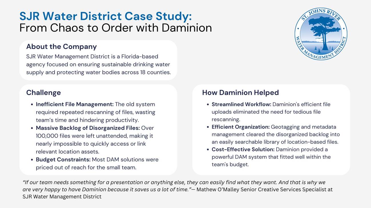
Now let’s take a brief look at how Daminion’s DAM with geotagging features has solved real-world problems faced by the companies managing geospatial data: West Gippsland CMA and St. Johns River Water Management District.
Choosing DAM with GIS Integration For Your Team
A DAM with GIS capabilities is truly a game changer if you work with location-based files. The team feels less stressed out about searching for the right assets, the quality of projects visibly improves, and the client satisfaction becomes a hallmark of your brand.
Ready to seize these benefits? As we’ve found out, there are some solid solutions on the market. Daminion’s comprehensive support for geospatial data coupled with other useful features and on-prem option makes it a robust and cost-effective choice.
Why not book a demo so you can test Daminion’s GIS features for yourself?
Discover How Daminion Can Work for You
Yes. Remote users can connect securely through VPN in on-premise setups, or use a cloud deployment for easier access across distributed teams.
Daminion helps keep costs predictable, especially in on-premise deployments, because teams use their own storage and infrastructure instead of paying ongoing per-gigabyte cloud storage fees.


Explore our DAM system
with your personal manager
demo from your dedicated manager.